Situated in central Christchurch on the corner of 25 Armagh Street and 3 Cranmer Square, the distinctive small timber building known as the Red House was built in 1899 for architect-owner, Samuel Hurst Seager, and is considered an important link in the development of a New Zealand style of architecture. Seager borrowed elements of its design from an earlier colonial building, Benjamin Mountfort’s Christchurch Club in Latimer Square, and this is thought to be the first time a New Zealand architect looked to the work of another New Zealand architect for direct inspiration. As such, Red House has outstanding architectural significance and aesthetic significance. Red House also has historical and social significance for its connection with a number of notable Canterbury identities, including two prominent architects and for the 60 years it was associated with medical practices, as well as cultural value for the nearly 50 years that the Cranmer Bridge Club was based there.
The Red House was built as an addition to an existing two storeyed brick dwelling that had been constructed in 1864 and purchased by Seager in 1899. Seager straight away designed and built the timber wing on the property’s Armagh Street frontage and for the next three years he based his architectural practice from here.
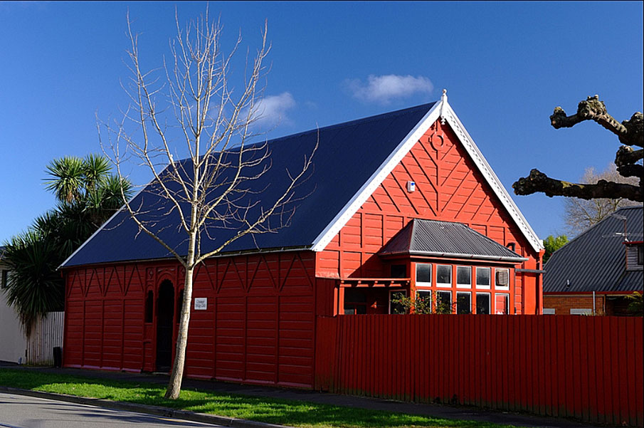
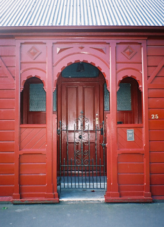
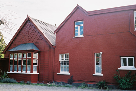
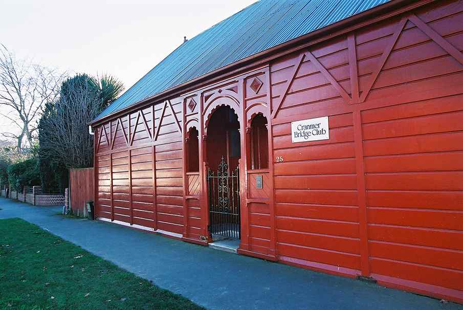
The Red House is a single storeyed gabled timber building, largely rectangular plan. Two distinctive features of the building are its deep red ochre paintwork and the main façade, fronting right onto Armagh Street, which has no fenestration but only a centrally placed decorative arched entry leading to a recessed porch and main entrance door. It is the detailing of this porch, with its main arch flanked by two minor arches and carved diamond shaped reliefs, that directly references features of Benjamin Mountfort’s Christchurch Club of 1859. On the east elevation is a box bay of sash windows and a decorative gable end that has diagonally laid battens on either side of a centrally laid vertical batten as well as dentils decorating the bargeboards. On the west elevation is a box bay of fixed and casement lead-light windows, and at the north-west corner is a low roofed porch and timber panelled door which functions as a back entrance.
The property – both original brick building and Seager’s timber Red House addition - had a number of changes in ownership throughout the twentieth century. From circa 1902 Seager leased part of the property to a series of medical professionals for use as consulting rooms. In 1907 he sold the property to fellow architect, John (J. J.) Collins. In 1911 Collins sold to soldier and runholder Leopold (L. G. D.) Acland. In 1921 Acland sold the property to Dr Douglas Anderson who had his general practitioner surgery in the main brick house (the entrance for which was via the north-western porch, waiting room and passage of the timber Red House addition) for 44 years. When Dr Anderson retired in 1963, the property was purchased by the Cranmer Bridge Club. In 2011, the original brick dwelling on the property was severely damaged in the Canterbury Earthquakes and demolished. The timber portion of the house – Seager’s 1899 addition – survived and has been restored. In 2016-2018 a new two storeyed residence was constructed adjacent, deliberately with a minimalistic modern exterior so as not to overwhelm the historic building. It sits on the northern side of the land parcel and is connected to the timber Red House at its south-west side, just as the previous red brick building had done before the earthquakes. The Red House forms the main Armagh Street entrance to the new building, but remains visually distinct and recognisable as the same significant piece of architecture designed by Seager in 1899.
The Red House was built as an addition to an existing two storeyed brick dwelling that had been constructed in 1864 and purchased by Seager in 1899. Seager straight away designed and built the timber wing on the property’s Armagh Street frontage and for the next three years he based his architectural practice from here.
The Red House is a single storeyed gabled timber building, largely rectangular plan. Two distinctive features of the building are its deep red ochre paintwork and the main façade, fronting right onto Armagh Street, which has no fenestration but only a centrally placed decorative arched entry leading to a recessed porch and main entrance door. It is the detailing of this porch, with its main arch flanked by two minor arches and carved diamond shaped reliefs, that directly references features of Benjamin Mountfort’s Christchurch Club of 1859. On the east elevation is a box bay of sash windows and a decorative gable end that has diagonally laid battens on either side of a centrally laid vertical batten as well as dentils decorating the bargeboards. On the west elevation is a box bay of fixed and casement lead-light windows, and at the north-west corner is a low roofed porch and timber panelled door which functions as a back entrance.
The property – both original brick building and Seager’s timber Red House addition - had a number of changes in ownership throughout the twentieth century. From circa 1902 Seager leased part of the property to a series of medical professionals for use as consulting rooms. In 1907 he sold the property to fellow architect, John (J. J.) Collins. In 1911 Collins sold to soldier and runholder Leopold (L. G. D.) Acland. In 1921 Acland sold the property to Dr Douglas Anderson who had his general practitioner surgery in the main brick house (the entrance for which was via the north-western porch, waiting room and passage of the timber Red House addition) for 44 years. When Dr Anderson retired in 1963, the property was purchased by the Cranmer Bridge Club. In 2011, the original brick dwelling on the property was severely damaged in the Canterbury Earthquakes and demolished. The timber portion of the house – Seager’s 1899 addition – survived and has been restored. In 2016-2018 a new two storeyed residence was constructed adjacent, deliberately with a minimalistic modern exterior so as not to overwhelm the historic building. It sits on the northern side of the land parcel and is connected to the timber Red House at its south-west side, just as the previous red brick building had done before the earthquakes. The Red House forms the main Armagh Street entrance to the new building, but remains visually distinct and recognisable as the same significant piece of architecture designed by Seager in 1899.